A. Multiple Choice Questions (MCQs)
Q1. Large landmasses of the earth are known as:
👉 Ans: (c) Continents
Q2. It is the true model of the earth.
👉 Ans: (d) Globe
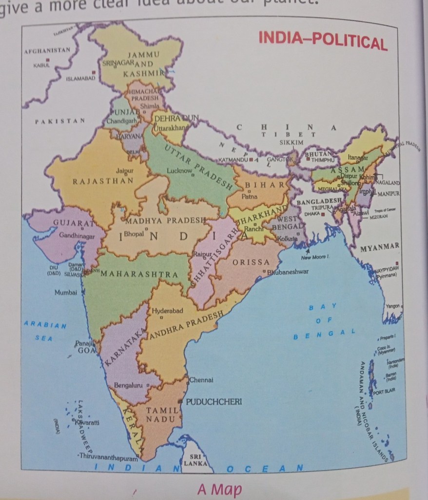
Q3. Which of the following maps shows different countries and their political divisions?
👉 Ans: (b) Political maps
Q4. It is not a cardinal direction.
👉 Ans: (c) South-west
Q5. Which of the following statements regarding the scale is wrong?
👉 Ans: (c) Scale shows the distance between the same places on the ground
B. Very Short Answer Questions
Q1. Define the term map.
👉 Ans: A map is a drawing of the Earth or a part of it on a flat surface.
Q2. Write down the cardinal directions.
👉 Ans: North, South, East, and West.
Q3. What do you know about physical maps?
👉 Ans: Physical maps show natural features like mountains, rivers, plains, and plateaus.
Q4. What is a large scale map?
👉 Ans: A large scale map shows a small area in detail.
Q5. Which colour is used to show water on the maps?
👉 Ans: Blue colour.
C. Short Answer Questions
Q1. Differentiate between the map and a sketch.
👉 Ans:
A map is drawn according to scale and is accurate.
A sketch is not drawn to scale and is rough.
Q2. What do you know about the sub-directions?
👉 Ans: Sub-directions are directions between the main directions, such as North-East, North-West, South-East, and South-West.
Q3. Give a short account on the different types of maps.
👉 Ans:
There are three main types of maps:
Physical maps (show natural features)
Political maps (show countries and boundaries)
Thematic maps (show specific information like climate, population)
Q4. What are the significances of the conventional symbols?
👉 Ans: Conventional symbols help us understand maps easily by representing features like roads, rivers, and buildings with signs.
✏️ Short Answer Type Questions
1. Differentiate between a map and a sketch.
Answer:
Map:
A map is a drawing of the Earth or a part of it made with proper scale and directions. It is accurate.
Sketch:
A sketch is a rough drawing without scale. It is not very accurate and is drawn from memory.
2. What do you know about sub-directions?
Sub-directions are the directions between the main (cardinal) directions.
They are:
North-East (NE)
North-West (NW)
South-East (SE)
South-West (SW)
They help us to find locations more accurately.
3. Give a short account of the different types of maps.
There are three main types of maps:
Physical maps – show natural features like mountains, rivers, plains
Political maps – show countries, states, cities and boundaries
Thematic maps – show specific information like rainfall, population, crops
4. What are the significances of conventional symbols?
Conventional symbols are standard symbols used on maps to represent features like roads, rivers, buildings, etc.
Importance:
Make maps easy to understand
Help people from different places read maps easily
Save space and time
Provide clear information without writing long descriptions.
D. Compare the following
Q1. Political and Physical maps
👉 Ans:
Political maps show countries, states, and boundaries.
Physical maps show natural features like mountains, rivers, and plains.
Q2. Physical and Thematic maps
👉 Ans:
Physical maps show natural features.
Thematic maps show specific information like climate, population, or rainfall.
Q3. Cardinal and sub-directions
👉 Ans:
Cardinal directions are North, South, East, and West.
Sub-directions are North-East, North-West, South-East, and South-West.
Q4. Map and Sketch
👉 Ans:
A map is drawn to scale and is accurate.
A sketch is not drawn to scale and is rough.
E. Fill in the blanks
1. A map which has no scale is called a sketch.
2. A globe is the model of the earth.
3. The water-bodies are shown in blue colour.
4. North is always towards the top of the map.
5. A map can be read easily through its symbols.
6. Scale is the ratio between map distance and ground distance.
F. Correctly match List I with List II
(I) Mosque → (b) symbol (picture)
(ii) Statement Scale → (e) 1 cm : 1 km
(iii) Post Office → (d) P.O.
(iv) Metalled Road → (a) dashed line
(v) International Boundary → (c) line
G. True / False
1. A map is a store house of information.
👉 True
2. Light blue colour is used to show deep water on the map.
👉 False (Dark blue shows deep water)
3. Large waterbodies of the earth surface are called oceans.
👉 True
4. A book of maps is called cartography.
👉 False (It is called an atlas)
H. Write the correct word
1. It is the science of map-making.
👉 Cartography
2. In this method a line is divided into a few equal parts.
👉 Linear scale
3. It shows large areas of the earth.
👉 Small scale map
4. It is the model of the earth.
👉 Globe
********************
